Why make time for it
Use the real San Francisco starting point, not a generic drive estimate. On the selected date, enter it and Natural Bridges State Beach in live directions. Leave only if both chosen legs show 180 minutes or less, the outward leg supports a latest 10:00 arrival, and the road, weather, vehicle, and return conditions are suitable. A map is a decision tool, not a traffic or arrival guarantee.
The protected Santa Cruz window is exactly 360 minutes: arrive by 10:00 and leave at 16:00. Keep that six-hour boundary intact. If either live drive no longer works, do not try to recover time by shortening safety checks, daylight, or the return decision.
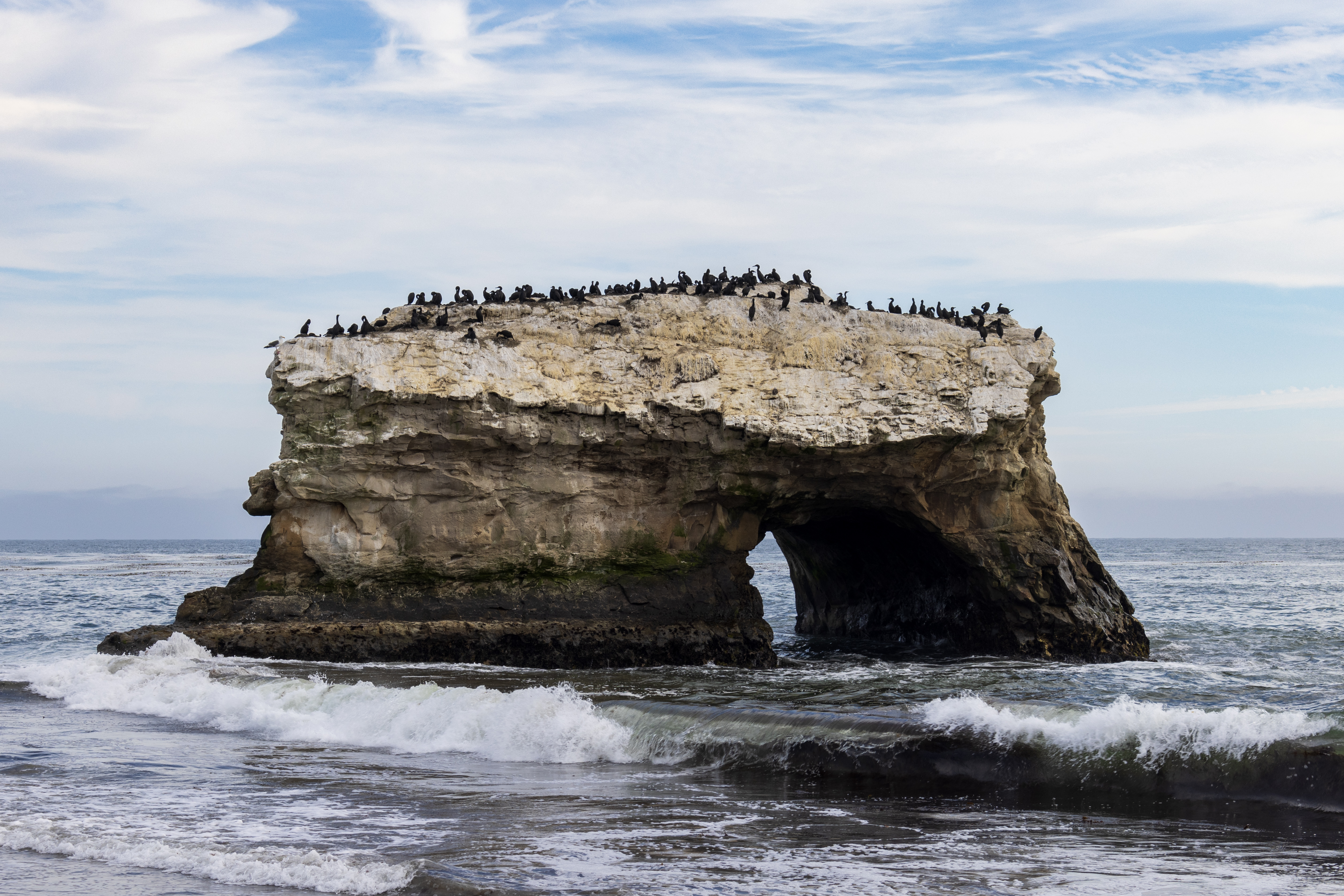
Natural Bridges State Beach is the core. Its official information describes the sea arch, beach, public-access tidepools, and wildlife viewing. This guide treats sea-arch and beach observation as the dependable outdoor piece. There are no lifeguards, and ocean conditions can change quickly; a view, wildlife sighting, calm water, or a tidepool visit is never promised.
The known core self-drive subtotal for two is $70–$150: a published $10 vehicle day-use line plus a self-selected $60–$140 food-and-drink allowance. The optional accessibility line is $0 only because no fixed cost is represented. It does not guarantee a wheelchair, accessible route, booking, or suitability. Fuel, tolls, vehicle costs, transit, special rates, alcohol, tax, gratuity, rentals, insurance, citations, booking arrangements, and purchases are excluded.
Tidepools are a separate low-tide and on-site decision. Check at the entrance station or visitor center first; never turn your back to waves or run on wet rocks. The visitor center has seasonal hours and may not fit your date. Santa Cruz METRO is only a local comparison after independently reaching the city, not a replacement San Francisco-to-Natural-Bridges route.
Who it suits
Good for
- drivers who will check live navigation before both legs
- travelers content with an exterior-first coast day
- people who will treat tidepools and the visitor center as optional
Less suited to
- anyone needing a guaranteed drive time or parking space
- travelers needing a fixed San Francisco-origin transit connection
- people who cannot protect the 16:00 return boundary
Getting there
Driving
This is a conditional self-drive itinerary. Use it only if live directions between the actual San Francisco endpoint and Natural Bridges show each selected leg at 180 minutes or less; confirm road, weather, vehicle, park, parking, surf, tide, and return conditions yourself.
Public transit
No San Francisco-origin transit connection, fare, duration, or Natural Bridges last mile is claimed. Santa Cruz METRO is only a local map, service-calendar, alert, and trip-planning comparison after independently reaching Santa Cruz.
Last mile
The entrance, viewing areas, tidepool decision point, visitor center, and picnic area are on-site choices. This guide does not promise an accessible route, visitor-center opening, tidepool access, wildlife viewing, or a fixed walking distance.
Parking
Confirm legal park parking before entering. The published vehicle day-use line is $10, but special rates may apply and prices can change. Accessible main-lot parking and picnic features exist, but selected-date conditions still control.
A day, in order
Your actual San Francisco starting point
Set the actual start and Natural Bridges State Beach in live directions. Leave only if the chosen outbound drive is 180 minutes or less and supports a latest 10:00 arrival.
Connection: A map estimate is not a traffic or arrival guarantee.
Natural Bridges State Beach
Confirm the park is open, the current vehicle day-use rate is acceptable, and legal parking is available. Published rates and the 08:00-to-sunset window can change or have special rules.
Connection: Keep the 16:00 return boundary visible.
Natural Bridges State Beach viewing area
Use a lawful public viewing or beach area only while current conditions are suitable. No lifeguard, surf, wildlife, or clear-view outcome is promised; follow posted restrictions and wave conditions.
Connection: Stay on the conservative side of the water.
Natural Bridges State Beach tidepool access
Enter tidepool areas only during a suitable current low tide after checking at the entrance station or visitor center. Never turn your back to waves or run on wet rocks; if the gate fails, remain at a lawful exterior viewpoint.
Connection: Skip tidepools without changing the core coastal visit.
Natural Bridges State Beach Visitor Center or picnic area
Use the visitor center only when its current seasonal schedule works; otherwise keep time for a self-selected meal in a lawful picnic area. A mobility aid or Monarch Trail needs its own selected-date access check.
Connection: Return to the entrance with time to spare.
Natural Bridges State Beach entrance
Leave only when live directions to the actual San Francisco endpoint still show 180 minutes or less and conditions are suitable. If the return gate fails, do not extend the visit; use a lawful alternative only after checking it independently.
Connection: Do not assume a transit substitute.
Budget for two
Published vehicle day-use fee only, subject to current entrance conditions, special rates, and changes.
Self-selected planning allowance for two, not a sourced menu-price claim. Alcohol, tax, gratuity, vehicle costs, fuel, tolls, and purchases are excluded.
No fixed price is represented. Beach wheelchair use is described as free with advance reservation recommended; $0 is not a guarantee of availability, booking, accessible route, or suitability.
Not included
fuel, tolls, vehicle costs, transit fare, special or event rates, alcohol, tax, gratuity, rentals, insurance, citations, booking arrangements, optional purchases
Before you leave
- 01Use your actual San Francisco start and Natural Bridges in live directions; require both chosen legs to be 180 minutes or less
- 02Protect a latest 10:00 arrival, a 16:00 departure boundary, and at least 360 minutes in Santa Cruz
- 03Check weather, road conditions, vehicle readiness, surf, tide, and a safe return plan
- 04Confirm current park opening, entrance conditions, $10 vehicle day-use line, and legal parking
- 05Treat tidepools as optional; check low tide and on-site conditions before entering
- 06Treat the Visitor Center as optional and confirm its seasonal date pattern before relying on it
- 07If accessibility support is needed, confirm selected-date accessible conditions and request any beach wheelchair ahead; $0 does not promise availability
- 08Keep fuel, tolls, vehicle costs, transit, special rates, alcohol, tax, gratuity, rentals, insurance, citations, booking arrangements, and purchases outside the $70–$150 core subtotal
- 09Do not use Santa Cruz METRO as a substitute without separately verifying a complete itinerary
Sources and review
- Google Maps — San Francisco to Natural Bridges State Beachselected-date live driving decision between actual San Francisco origin and Natural Bridges, each chosen drive leg must be 180 minutes or lessChecked 2026-07-30 · Review by 2026-07-31
- California State Parks — Natural Bridges State Beach08:00-to-sunset hours, $10 vehicle day use, possible special rates, and parking boundary, sea arch, beach, tidepool safety, no-lifeguard warning, Visitor Center hours, and dog boundaryChecked 2026-07-30 · Review by 2026-07-31
- Santa Cruz METRO — Rider's Guidelocal maps, service calendar, alerts, trip planning, and real-time comparison only; not a claimed origin routeChecked 2026-07-30 · Review by 2026-07-31
- California State Parks — Accessible Features at Natural Bridges State Beachaccessible picnic/main-lot features, 0.13-mile Monarch Trail boardwalk, and conditional free beach-wheelchair arrangementChecked 2026-07-30 · Review by 2026-07-31
- Natural bridge, Santa Cruz 2023-07-16 (1).jpgThe wub attribution and CC BY-SA 4.0 for the real-location photographChecked 2026-07-30 · Review by 2031-07-30
.jpg)